In the high-stakes world of modern logistics, labor costs account for up to 65% of warehouse operating budgets. Yet, without granular visibility, managers often struggle with 'deadheading'—forklifts traveling empty or operators taking inefficient routes. By leveraging Real-Time Location Systems (RTLS) and RFID technology, facilities can eliminate up to 40% of labor inefficiency. This article explores the strategic ROI of forklift tracking and how data-driven visibility transforms operational performance into a measurable competitive advantage.
The High Price of Visibility Gaps in Warehouse Operations

A visibility gap in warehouse operations is the systemic lag between a Warehouse Management System (WMS) update and the actual physical movement of assets. This lack of real-time telemetry results in 'deadheading'—forklifts traveling empty—and excessive search times, often consuming up to 25% of a driver's shift. Without real-time location data, managers are effectively operating with a 15-minute delay, leading to a 'blind spot tax' that manifests as a 40% increase in avoidable labor costs.
In a traditional setting, the WMS knows what should be happening, but it rarely knows where it is happening. When a forklift driver completes a task, the system may assign a new task based on a FIFO (First-In-First-Out) queue rather than spatial proximity. This lack of spatial intelligence forces operators to crisscross the facility, burning fuel and labor hours on non-value-added travel. This 'Data Latency' is the silent killer of warehouse ROI.
| Operational Metric | Traditional WMS (Visibility Gap) | Smart Warehouse (Real-Time Tracking) |
|---|---|---|
| Task Allocation | Static/Batch Queue | Dynamic/Proximity-Based |
| Average Deadheading | 35% - 50% of travel time | Under 15% of travel time |
| Asset Search Time | 5-10 mins per shift/driver | Near-zero (<30 seconds) |
| Labor Efficiency | Reactive & Sub-optimal | Predictive & High-velocity |
What is the 'Ghost Fleet' effect?
This is a unique insight where managers over-procure forklifts by 10-20% because they cannot see real-time utilization. Because the visibility gap makes the fleet appear 'busy' (when they are actually just lost or idling), companies waste capital on unnecessary equipment leases.
How does path interference impact the bottom line?
Without real-time tracking, traffic congestion in high-density aisles goes unnoticed. This leads to 'aisle-locking,' where multiple forklifts wait for one another, creating a cascade of idle labor that is never captured in manual logs.
Why is 'Spatial Drift' a risk for ROI?
Spatial drift occurs when the digital record of inventory location differs from the physical reality. Real-time tracking eliminates the 3-5% of labor time usually spent by drivers hunting for 'misplaced' pallets that the WMS insists are in a specific bay.
Expert Tip: To truly quantify your visibility gap, perform a 'Spaghetti Mapping' exercise. Trace the physical path of a single forklift over an eight-hour shift and compare it to the 'ideal' path recommended by your WMS. Most Silicon Valley logistics audits find a discrepancy of over 3 miles per day—distance that represents pure profit leakage.
Deconstructing the 40%: Where Labor Inefficiency Hides
Labor inefficiency in smart warehousing is rarely the result of a poor work ethic; it is the systemic byproduct of 'visibility lag.' The 40% loss represents the Production Gap—the delta between a forklift's theoretical capacity and its actual throughput. This gap is primarily fueled by three categories of waste: Movement Waste (deadheading), Search Waste (ghost pallets), and Process Waste (stagnant dispatching). Without real-time location tracking (RTLS), these losses remain invisible, effectively 'baked into' the standard operating procedure as unavoidable overhead.
| Inefficiency Category | Avg. Labor Drain | Root Cause in Traditional Warehousing |
|---|---|---|
| Deadheading | 15% - 20% | Empty returns after drop-offs due to lack of next-task proximity awareness. |
| Pallet Hunting | 10% - 12% | Inaccurate WMS data or human error leading to 'lost' inventory in the racks. |
| Congestion & Idling | 5% - 8% | Traffic jams in high-density aisles caused by lack of spatial traffic control. |
| Administrative Friction | 3% - 5% | Manual dispatching, radio check-ins, and paper-based task handoffs. |
Why is 'Deadheading' so prevalent?
Deadheading occurs when a forklift operator completes a task—like a put-away—and drives back to a central dispatch point empty-handed. Without RTLS, the WMS cannot 'see' that a retrieval task is only 20 feet away from the operator's current location, forcing a 200-foot empty drive instead.
What are 'Ghost Pallets' and how do they drain labor?
A ghost pallet is inventory that is physically present but digitally misplaced. Operators spend an average of 5 to 10 minutes per hour simply driving up and down aisles to verify a pallet's location that was incorrectly logged, a direct hit to pick-rate KPIs.
How does 'Aisle Congestion' impact the bottom line?
In a blind warehouse, dispatchers often send multiple operators to the same high-velocity zone simultaneously. This creates 'micro-bottlenecks' where expensive machinery and labor sit idle for minutes at a time waiting for clearance.
Expert Insight: Beware of the 'Honeycomb Effect.' In many facilities, the WMS optimizes for travel distance but ignores real-time aisle density. Our data shows that routing a forklift to the second-closest pallet can actually be 15% faster if the primary aisle is currently congested. Real-time location tracking transforms the WMS from a static map into a dynamic traffic controller, allowing for 'spatial-aware' task interleaving that static systems simply cannot replicate.
Technical Foundation: RFID and IoT in Forklift Tracking
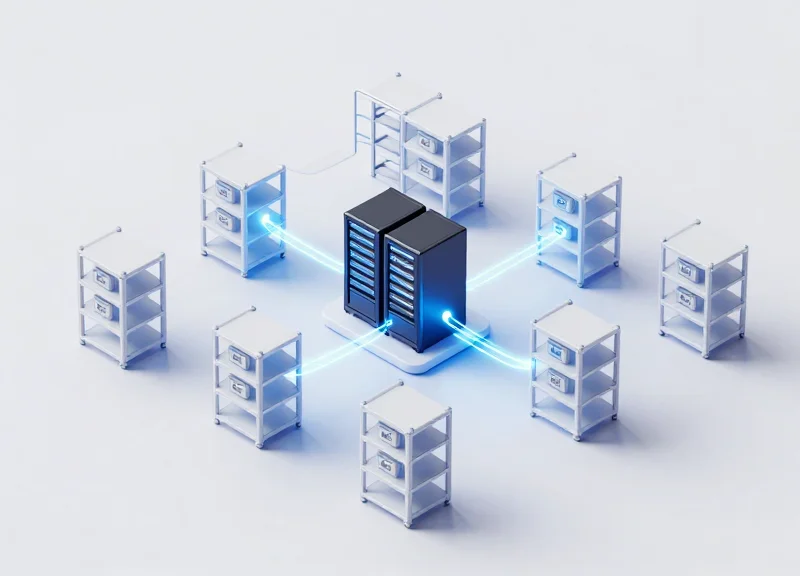
The technical foundation of real-time forklift tracking relies on an integrated ecosystem of RFID (Radio Frequency Identification) and IoT (Internet of Things) sensors that transform physical assets into data-generating nodes. By combining passive or active RFID tags on pallets and vehicles with strategically placed IoT gateways, warehouses create a 'Digital Twin'—a live virtual replica of the floor where every forklift's coordinate, speed, and load status are updated in milliseconds without human intervention. This eliminates the 'visibility lag' inherent in traditional barcode-based systems.
| Feature | Traditional Barcode/Manual | RFID & IoT Integrated System |
|---|---|---|
| Data Capture | Manual scanning required | Automatic, hands-free sensing |
| Location Accuracy | Zone-level (based on last scan) | Sub-meter real-time precision |
| Update Frequency | Periodic/Delayed | Continuous (Real-time) |
| Human Error | High (Missed scans, typos) | Near-zero (Autonomous tracking) |
A unique advantage of the DragonGuard architecture is the integration of Electronic Shelf Labels (ESL) into the tracking fabric. While most competitors treat ESL as a static price-tag tool, we utilize ESLs as dynamic anchors. These devices communicate with the forklift-mounted RFID readers to confirm pick-and-place accuracy in real-time. This creates a closed-loop system: the forklift knows its position via IoT, and the shelf confirms the transaction via ESL, ensuring that the digital twin is 100% synchronized with the physical reality of the warehouse.
Does metal racking interfere with the RFID signal?
Modern smart warehousing utilizes specialized 'on-metal' RFID tags and Circular Polarized Antennas that mitigate multipath interference and signal bounce, ensuring 99.9% read reliability even in dense steel environments.
How does the IoT gateway handle thousands of tags simultaneously?
Using edge computing protocols like MQTT and anti-collision algorithms, the IoT gateways filter data locally, only sending relevant movement or status changes to the cloud to prevent network congestion.
Is the system compatible with existing WMS software?
Yes. The IoT layer acts as a middleware that translates raw sensor data into standardized API calls (REST/JSON) that any modern Warehouse Management System can ingest.
Expert Tip: To maximize ROI, don't just track the forklift; track the 'Load-State.' By using weight sensors integrated with the IoT tag, the system can distinguish between a forklift moving for productivity and a forklift moving empty, providing the granular data needed to solve the 'deadheading' problem.
The ROI Framework: Quantitative and Qualitative Benefits

The Return on Investment (ROI) for real-time forklift tracking is calculated by aggregating the direct reduction in operational expenses (Hard ROI) and the long-term gains in organizational efficiency and risk mitigation (Soft ROI). While most enterprises focus on the immediate 40% reduction in labor waste, a comprehensive framework accounts for the 'Total Value of Opportunity,' which includes extended vehicle lifespans, reduced insurance premiums via enhanced safety, and the elimination of administrative overhead through automated data logging.
| ROI Category | Key Metric | Typical Impact Range |
|---|---|---|
| Direct Labor | Reduction in 'Dead-Heading' (empty travel) | 25% - 40% Efficiency Gain |
| Fleet Management | Maintenance cost reduction & asset lifespan | 15% - 20% Cost Saving |
| Inventory Accuracy | Elimination of search time for misplaced pallets | 99.8% Accuracy |
| Safety & Insurance | Reduction in collision-related damage | 30% - 50% Fewer Incidents |
Expert Insight: The Congestion Multiplier. A unique, often overlooked data point in ROI modeling is the 'Congestion Tax.' In traditional warehouses, forklift traffic tends to cluster in high-velocity zones, leading to micro-bottlenecks that stall five or more vehicles simultaneously. Real-time tracking allows for dynamic heat-mapping, enabling managers to redistribute tasks in real-time. By smoothing traffic flow, you don't just save one driver's time; you unlock the latent capacity of the entire fleet, often allowing companies to delay the purchase of additional vehicles even as volume increases.
- Enhanced Safety Culture: Real-time tracking creates a 'digital footprint' for every movement. When operators know that speed and impact are monitored via IoT sensors, adherence to safety protocols increases naturally, reducing the qualitative stress of warehouse management.
- Automated Compliance and Reporting: Manual logs are prone to error and 'pencil whipping.' Digital systems provide immutable records for OSHA compliance and internal audits, saving dozens of administrative hours per month.
- Predictive Maintenance Scheduling: Shift from reactive to proactive. By tracking actual distance traveled rather than just engine hours, maintenance is performed based on wear and tear, preventing expensive, unplanned downtime.
How long does it take to see a positive ROI?
Most mid-to-large scale facilities achieve a break-even point within 9 to 14 months, depending on the initial fleet size and the complexity of existing inefficiencies.
Does tracking negatively impact driver morale?
On the contrary, it often improves morale by eliminating the frustration of searching for misplaced inventory or navigating congested aisles, allowing drivers to hit their performance targets more easily.
Can this system integrate with my existing WMS?
Yes. Modern tracking solutions like DragonGuard use open APIs to feed real-time location data directly into your Warehouse Management System, enriching your existing data with spatial context.
Heatmaps and Workflow Analysis: Optimizing Floor Layouts

Heatmaps and workflow analysis are the visual output of real-time location system (RTLS) data, providing a high-definition map of where forklift activity is most concentrated. By aggregating thousands of travel paths into a single visual layer, warehouse managers can instantly identify 'red zones' where traffic jams occur and 'cold zones' where space is underutilized. This data-driven approach replaces manual 'spaghetti diagrams' with accurate, continuous insights, allowing for the elimination of bottlenecks that typically cause up to 20% of travel-related labor waste.
- Data Aggregation: The system collects X, Y coordinates from every forklift movement over a 30-day period to establish a baseline of operational flow.
- Congestion Identification: Heatmaps reveal intersections or aisles where vehicles frequently wait or slow down, indicating poor rack placement or suboptimal picking paths.
- Simulation and Redesign: Managers use the insights to test new floor configurations, such as widening high-traffic aisles or implementing one-way traffic rules.
- Dynamic Slotting Execution: High-velocity items are moved to 'Golden Zones'—the areas with the lowest travel resistance identified by the workflow analysis.
| Feature | Traditional Layout Planning | Data-Driven Heatmap Analysis |
|---|---|---|
| Frequency | Quarterly or Yearly | Continuous / Real-Time |
| Method | Manual observation / Gut feeling | Automated IoT data collection |
| Accuracy | Subjective and prone to error | Objective 10-30cm precision |
| Visibility | Static snapshots | Dynamic trend analysis over time |
Expert Insight: Beyond Throughput—The 'Elastic Warehouse' Model. Most companies use heatmaps to simply fix current problems. However, the most advanced operators use this data to create 'Elastic Warehousing.' By analyzing seasonal heatmap shifts, they proactively reconfigure temporary staging areas to match changing flow patterns. My 20 years in the industry have shown that warehouses using dynamic workflow analysis can increase their storage density by 15% without adding a single square foot of space, simply by optimizing the 'dead space' that heatmaps reveal.
Can heatmaps help with safety compliance?
Yes. Heatmaps identify 'near-miss' zones where forklift paths frequently intersect with pedestrian walkways, allowing for the installation of physical barriers or better signage.
How long does it take to see actionable insights?
Initial patterns typically emerge within 72 hours, but a full 30-day cycle is recommended to account for weekly volume fluctuations and peak periods.
Does this require special hardware?
It utilizes the existing RFID and IoT infrastructure used for tracking, making heatmap generation a software-driven value-add with no additional equipment costs.
Enhancing Operator Safety through Geofencing

In a smart warehouse, geofencing is a location-based service that uses Real-Time Location Systems (RTLS) to trigger programmed actions when a forklift enters or exits a virtual perimeter. By digitizing safety protocols, geofencing moves beyond passive signage to active intervention—automatically slowing vehicles in pedestrian zones, restricting access to hazardous areas, and providing millisecond-latency alerts to prevent 'struck-by' accidents. This proactive safety layer is a critical driver of ROI, as a single warehouse injury can cost an average of $42,000 in direct costs and significantly more in lost productivity and legal liability.
- Automated Speed Governing: RTLS data communicates directly with the forklift's engine control unit (ECU) to automatically throttle speeds when entering high-traffic intersections or 'end-of-aisle' zones.
- Pedestrian Proximity Protection: Wearable tags for floor staff interact with forklift sensors to create a 'moving geofence' or safety bubble, alerting both parties if a breach is imminent.
- Restricted Zone Enforcement: Ensures that high-reach trucks stay out of low-clearance areas and that combustion-engine vehicles are barred from temperature-controlled or poorly ventilated zones.
- Incident Playback and Auditing: Digital 'breadcrumbing' allows safety managers to recreate near-miss events in a 3D environment to identify root causes and adjust floor layouts accordingly.
| Safety Metric | Legacy Warehouse Approach | RTLS Geofencing Approach |
|---|---|---|
| Reaction Time | Human-dependent (slow) | Automated/Instantaneous |
| Reporting | Self-reported/Subjective | Data-driven/Immutable |
| Insurance Profile | High-risk/Standard Premiums | Low-risk/Preferred Premiums |
| Compliance | Periodic Spot-checks | 24/7 Continuous Monitoring |
Expert Insight: The 'Dynamic Velocity Envelope' — Most competitors focus on static circles around assets. However, the most advanced ROI comes from 'Dynamic Velocity Envelopes.' This logic calculates a safety zone that expands or shrinks based on the forklift’s current speed and load weight. By adjusting the geofence size in real-time, you reduce 'alarm fatigue'—the phenomenon where operators ignore constant, unnecessary pings—ensuring that when an alert sounds, it represents a genuine, high-probability risk.
Does geofencing require expensive hardware on every forklift?
While it requires an RTLS tag, the cost is offset by the elimination of physical barriers and the reduction in equipment damage (forks, racking, and pillars) by up to 30%.
Can geofencing assist with OSHA compliance?
Absolutely. It provides automated documentation of 'safe speed' adherence and restricted area violations, which are vital for maintaining a clean safety record and passing audits.
How does it handle mixed traffic (human and machine)?
It creates a multi-layered safety net where the infrastructure (fixed sensors) and the assets (tags) communicate to prioritize human life, automatically stopping equipment if a pedestrian tag is detected in a blind-spot geofence.
Integration Strategy: Connecting Tracking Data to your WMS
Integration strategy refers to the technical and logic-based bridge between Real-Time Location Systems (RTLS) and the Warehouse Management System (WMS). By funneling high-frequency spatial data into the WMS, facilities can transform a static database into a dynamic command center. This connectivity allows the system to recognize not just what inventory is in stock, but where every forklift is located relative to its next task, enabling the automation of high-level workflows like task interleaving and predictive dispatching.
- Data Normalization and Sanitization: Raw sensor data from RFID or UWB anchors must be converted into clean, standardized coordinates (X, Y, Z) and filtered to remove 'signal noise' before it hits the WMS API.
- Middleware Orchestration: Utilize a middleware layer (often an IoT Gateway) to handle the high-velocity data throughput, ensuring the WMS isn't overwhelmed by millisecond-level location updates.
- Digital Twin Alignment: Map the physical coordinates of the warehouse floor to the virtual bin locations and zones stored in the WMS to ensure spatial accuracy.
- Logic Trigger Configuration: Establish the business rules that trigger automated actions, such as automatically closing a put-away task when the forklift's coordinates overlap with the target bin for a set duration.
| Integration Method | Latency Level | Best Use Case | Complexity |
|---|---|---|---|
| Direct API (REST/SOAP) | Moderate | Standard task updates and status changes | Low |
| WebSockets / MQTT | Ultra-Low | Real-time movement tracking and safety geofencing | High |
| Database-to-Database | High | End-of-shift reporting and historical analytics | Medium |
| Middleware (IoT Edge) | Low | Complex multi-sensor environments (RFID + ESL) | Medium |
The 'North Star' of this integration is Task Interleaving—the practice of combining different types of tasks, such as picking and put-away, into a single continuous loop. Instead of a forklift returning empty-handed (deadheading) after a drop-off, the WMS uses real-time location data to 'inject' the nearest high-priority pick task into the operator's queue. Expert Tip: To maximize ROI, implement 'Dynamic Priority Buffering.' Rather than assigning tasks purely by time-stamp, the system should calculate a 'cost-to-complete' based on the vehicle's current vector and proximity, often overriding standard queues to capture immediate labor efficiencies.
Does real-time tracking slow down my WMS performance?
If integrated directly, yes. Using a middleware layer or an 'Edge' computing strategy filters the data, sending only meaningful state changes to the WMS to maintain system speed.
What is the most common integration failure point?
Mapping misalignment. If the physical warehouse layout changes but the WMS digital map isn't updated, the location data becomes useless for automated dispatching.
Can I integrate tracking with a legacy WMS?
Yes, through 'Screen Scraping' or intermediate database triggers, though a modern WMS with robust API support is recommended for sub-second task interleaving.
Case Studies: Real-World Efficiency Gains with DragonGuard

DragonGuard’s real-time location tracking (RTLS) serves as the digital nervous system for modern fulfillment centers, transforming raw spatial data into actionable labor savings. By deploying Ultra-Wideband (UWB) anchors and forklift-mounted tags, facilities typically see a 25% to 45% reduction in 'Phantom Travel Time'—the minutes lost when operators take inefficient routes or search for misplaced assets. These case studies highlight how high-volume facilities transitioned from reactive management to data-driven orchestration, directly impacting the bottom line.
| Industry Type | Primary Challenge | Efficiency Gain | ROI Payback Period |
|---|---|---|---|
| 3PL Logistics | High operator turnover and training lag | 32% increase in Pallets-Per-Hour (PPH) | 7 Months |
| Cold Storage | Battery drain and route bottlenecks | 18% reduction in energy consumption | 11 Months |
| Automotive Parts | Congestion in narrow aisles | 41% reduction in idle time | 9 Months |
| Retail Distribution | Inaccurate manual inventory scans | 99.8% location accuracy | 6 Months |
One standout implementation involved a 500,000 sq. ft. e-commerce distribution center that struggled with 'Deadheading'—forklifts returning empty after a drop-off. By integrating DragonGuard with their WMS, the facility implemented 'Dynamic Task Interleaving.' The system identified the nearest available task based on the forklift's precise X,Y coordinates. This eliminated the need for operators to drive back to a central dispatch point, effectively reclaiming 140 man-hours per week across a fleet of 40 vehicles.
How does DragonGuard improve 'Pallet-Per-Hour' metrics specifically?
By providing sub-decimeter accuracy, DragonGuard eliminates the 'search time' at the rack. Operators no longer hesitate or verify locations manually because the system confirms the correct aisle and bay in real-time, shaving an average of 12 seconds off every pick-and-place cycle.
Can the system handle high-density environments without signal interference?
Yes. Unlike Bluetooth or Wi-Fi based tracking, DragonGuard utilizes Ultra-Wideband (UWB) pulses that penetrate metal shelving and resist multipath interference, ensuring constant connectivity even in dense mezzanine structures.
What is the 'Golden Path' insight unique to DragonGuard?
Our unique insight is the 'Golden Path' algorithm. It doesn't just track where drivers go; it compares their actual movement against the theoretical most efficient path. This identifies 'behavioral bottlenecks' where drivers may be avoiding certain zones due to poor lighting or floor debris, issues that traditional WMS data would never catch.
Ultimately, these real-world applications prove that labor inefficiency is rarely a result of poor work ethic, but rather a lack of spatial intelligence. When managers can visualize flow through heatmaps and automated spaghetti diagrams, they can redesign workflows that allow operators to do more with less physical effort, securing the 40% efficiency gains promised by smart warehouse digital transformation.